Unlock your full potential by mastering the most common Time-Lapse and 4D Seismic Analysis interview questions. This blog offers a deep dive into the critical topics, ensuring you’re not only prepared to answer but to excel. With these insights, you’ll approach your interview with clarity and confidence.
Questions Asked in Time-Lapse and 4D Seismic Analysis Interview
Q 1. Explain the principles behind 4D seismic acquisition.
4D seismic acquisition involves acquiring multiple 3D seismic surveys of the same area over time, typically during different phases of hydrocarbon production. The principle lies in monitoring changes in subsurface properties, primarily related to fluid movement (e.g., oil, gas, water) within the reservoir. This is achieved by comparing the seismic data acquired at different times. Think of it like taking repeated medical scans of a patient; each scan provides a snapshot, and comparing the scans reveals changes in the patient’s condition over time. Similarly, comparing multiple 3D seismic surveys allows us to see how the reservoir is responding to production.
The process involves careful planning to ensure repeatability. Survey parameters like source and receiver positions, navigation systems, and data acquisition parameters are meticulously documented and repeated as closely as possible in subsequent surveys. This ensures that differences observed in the final 4D data are genuine reservoir changes and not simply artifacts of acquisition variations.
Q 2. Describe the workflow for processing 4D seismic data.
The workflow for processing 4D seismic data is a complex, multi-step process. It begins with individual processing of each 3D seismic survey, similar to standard 3D processing. This involves steps like noise attenuation, deconvolution, velocity analysis, and migration to create a high-resolution image of the subsurface.
- Pre-stack and Post-stack processing: Noise reduction techniques, such as f-k filtering and surface-consistent deconvolution, are crucial at both stages to minimize noise and enhance signal fidelity.
- Time-lapse processing: Once each 3D volume is processed, the focus shifts to time-lapse processing. This involves aligning the different 3D surveys in time and space precisely. This crucial step is often done using cross-correlation techniques, ensuring we’re comparing ‘apples to apples’. Any remaining inconsistencies or misalignments can mask the true reservoir changes.
- Difference volume generation: Finally, a crucial step is generating a difference volume (also called a ‘4D volume’). This is essentially a subtraction of one seismic volume from another, highlighting changes in reflectivity between the acquisition times. This difference volume is the key output for interpretation, revealing where fluid movement has occurred.
Throughout this workflow, careful quality control is imperative. Any inconsistency between surveys can lead to spurious results.
Q 3. What are the key challenges in 4D seismic interpretation?
Interpreting 4D seismic data presents several challenges. The most significant is differentiating genuine reservoir changes from noise and artifacts introduced during acquisition, processing, or by natural variations in the subsurface. For example, subtle changes in reservoir pressure can lead to small seismic amplitude variations, which can be easily masked by noise.
- Seismic noise: Environmental changes, changes in equipment, or even subtle variations in the Earth’s surface between surveys can cause noise.
- Repeatability issues: Ensuring consistent acquisition parameters across all surveys is crucial, but often challenging due to weather conditions or other unforeseen factors. Even small inconsistencies can create false changes in the 4D data.
- Resolution limitations: The resolution of seismic data limits our ability to detect small-scale changes. This means we may miss subtle changes in reservoir properties.
- Ambiguity in interpretation: The change observed in the 4D volume is often a combination of various effects. The challenge lies in unraveling the contribution of each parameter (fluid pressure, saturation, etc.) to the observed changes.
Successful interpretation requires a multidisciplinary approach, integrating 4D seismic data with other reservoir data (production logs, well tests) to reduce ambiguity and enhance confidence in the interpretations.
Q 4. How do you handle noise and artifacts in 4D seismic data?
Handling noise and artifacts in 4D seismic data is paramount. A variety of techniques are employed to mitigate their effects. The key is to identify and remove the noise without also affecting the real reservoir changes.
- Pre-processing techniques: Techniques like predictive deconvolution, surface consistent filtering, and multiple attenuation are applied to reduce random noise and unwanted reflections.
- Statistical methods: Advanced statistical methods like robust estimation and wavelet analysis can help separate noise from the actual signal. These methods are especially effective at identifying and attenuating noise that is not easily removed by conventional methods.
- Careful survey design: Good survey design goes a long way to reducing problems. By carefully choosing source and receiver locations and recording parameters, acquisition-related noise can be significantly reduced.
- Signal enhancement techniques: Methods like post-stack migration and anisotropic velocity modeling can enhance the signal-to-noise ratio and improve the resolution of the 4D images.
It’s a continuous process. Noise reduction is performed at multiple stages, from the initial raw data to the final 4D difference volume. The effectiveness of these techniques is often evaluated visually and quantitatively by comparing results from different methods.
Q 5. What are the limitations of 4D seismic technology?
Despite its power, 4D seismic technology has limitations.
- High cost: Acquiring multiple 3D surveys over time is expensive. The cost of acquiring, processing and interpreting the data can be substantial.
- Time constraints: The time lag between surveys can introduce complications. Changes in the reservoir can be significant between surveys, making it difficult to track continuous changes.
- Resolution limitations: Seismic data has inherent resolution limitations. We cannot resolve every detail of the reservoir’s response to production, particularly in complex geological settings.
- Interpretation ambiguity: Changes observed in the 4D data can be due to multiple factors (pressure, saturation, temperature). Deconvolving these effects to understand each contribution is challenging.
- Sensitivity to noise: Subtle reservoir changes can be masked by noise, even after extensive processing.
These limitations should be considered when planning and interpreting 4D seismic studies. Understanding these constraints can avoid unrealistic expectations and guide the development of efficient workflows.
Q 6. Explain different types of time-lapse seismic attributes.
Time-lapse seismic attributes quantify changes observed in the 4D seismic data. They provide a more detailed characterization of reservoir behavior than simple amplitude changes.
- Amplitude changes: The most basic attribute, representing the difference in seismic amplitude between two surveys. These changes can indicate changes in fluid saturation or pressure.
- Frequency changes: Changes in the dominant frequencies of the seismic signal can reveal changes in reservoir properties, such as porosity or lithology.
- Velocity changes: Changes in seismic velocity indicate variations in reservoir properties, often related to pressure changes.
- AVO changes: Changes in Amplitude Versus Offset (AVO) attributes can provide information about changes in fluid type and saturation.
- Seismic coherence: Measures the similarity of seismic reflections in a localized area, helpful for tracking fractures or fault movement.
The choice of attributes depends on the specific geological setting and the type of reservoir response being investigated. Sophisticated analysis often involves combining multiple attributes to achieve a more comprehensive understanding.
Q 7. How can 4D seismic data be integrated with other reservoir data?
Integrating 4D seismic data with other reservoir data is crucial for maximizing its value. This synergistic approach reduces ambiguity and improves the accuracy of reservoir models.
- Production data: Integrating production data (oil, gas, and water rates, pressure, and injection data) with 4D seismic data allows for direct calibration of seismic observations with actual reservoir performance.
- Well logs: Well logs provide high-resolution information on reservoir properties at specific well locations. Combining this with the broader-scale information from 4D seismic data improves the characterization of reservoir heterogeneity.
- Geological models: Integrating 4D seismic data into geological models helps to refine the understanding of reservoir architecture and its response to production. It helps to constrain the parameters of reservoir simulation models.
- Reservoir simulation: 4D seismic data can be used to validate and calibrate reservoir simulation models. This allows for more accurate predictions of future reservoir behavior.
This integrated approach uses different data types to complement each other. The combination provides a more complete and accurate picture of the reservoir than any single data type could provide on its own.
Q 8. Describe the use of 4D seismic in reservoir monitoring and management.
4D seismic, also known as time-lapse seismic, is a powerful reservoir monitoring technique. It involves acquiring multiple 3D seismic surveys of the same area over time, typically during different stages of reservoir production. By comparing these datasets, we can identify changes in subsurface properties, like pressure, saturation, and fluid movement. This allows for a dynamic view of the reservoir, far exceeding the static snapshot provided by a single 3D survey.
In reservoir management, 4D seismic data helps optimize production strategies. For instance, by visualizing the movement of fluids (oil, gas, water), operators can better understand reservoir connectivity, identify bypassed hydrocarbons, and make informed decisions regarding well placement, water injection strategies, and enhanced oil recovery techniques. Imagine it like a medical MRI – a static image tells you something, but a series of images over time reveals the dynamic changes within the body, allowing for more precise diagnosis and treatment. Similarly, 4D seismic provides a dynamic understanding of reservoir behavior, leading to more efficient production and maximized resource recovery.
Q 9. Explain the concept of repeatability in 4D seismic surveys.
Repeatability in 4D seismic refers to the consistency and reliability of acquiring seismic data across multiple surveys. High repeatability is crucial because it ensures that observed changes are truly representative of reservoir changes, not artifacts introduced by variations in acquisition or processing. Factors affecting repeatability include:
- Acquisition parameters: Maintaining consistent source and receiver locations, geometries, and parameters (e.g., source energy, sampling rate) across surveys is vital. Even small variations can significantly impact the final data.
- Environmental conditions: Weather, sea state (for marine surveys), and ground conditions can affect data quality. Minimizing these variations is crucial for good repeatability.
- Processing techniques: A consistent processing workflow is essential. Different processing strategies can result in apparent changes in the data that are not related to reservoir changes.
Achieving high repeatability requires meticulous planning and execution. Sophisticated navigation systems, advanced processing techniques like wavelet deconvolution and noise attenuation, and rigorous quality control are critical for minimizing errors and ensuring the reliability of 4D seismic interpretation.
Q 10. How do you quantify uncertainty in 4D seismic interpretation?
Quantifying uncertainty in 4D seismic interpretation is paramount to avoid misinterpretations and to provide realistic estimates of reservoir changes. This is typically addressed through several methods:
- Statistical analysis: Analyzing the signal-to-noise ratio (SNR), estimating the variance of seismic attributes, and applying statistical tests help quantify the uncertainty associated with individual attribute changes.
- Stochastic modeling: Generating multiple realizations of the reservoir model based on the seismic data and incorporating uncertainty in seismic attributes and rock physics relationships provides a range of possible scenarios.
- Rock physics uncertainty analysis: Considering the uncertainty associated with rock physics models used to relate seismic attributes to reservoir properties (e.g., porosity, saturation) helps assess the impact of these uncertainties on the final interpretation.
- Cross-validation techniques: Splitting the data into training and testing sets to assess the predictive capability of the interpretation workflow.
By rigorously addressing these uncertainties, we can provide a more realistic and reliable assessment of the reservoir dynamics, leading to better-informed decisions.
Q 11. What are the various methods for 4D seismic data pre-processing?
4D seismic data pre-processing is crucial for enhancing the signal-to-noise ratio and ensuring the repeatability of the surveys. Key steps include:
- Navigation and geometry corrections: Correcting for variations in source and receiver positions between surveys.
- Deconvolution: Removing the effects of the source wavelet to improve temporal resolution.
- Multiple attenuation: Removing unwanted reflections from subsurface interfaces that interfere with primary reflections of interest.
- Noise attenuation: Reducing random noise from various sources, including ground roll, ambient noise, and acquisition-related artifacts.
- Amplitude and phase preservation: Ensuring that the amplitudes and phases of seismic reflections are accurately preserved throughout the processing workflow, which is essential for quantitative 4D analysis.
- Seismic data regularization: Various techniques for handling the differences between datasets (e.g., time shifts, amplitude scaling).
Choosing appropriate pre-processing techniques depends on the specific data quality and the geological setting. Careful attention to these steps is essential for ensuring the accuracy and reliability of the subsequent 4D interpretation.
Q 12. Describe the role of seismic inversion in 4D seismic analysis.
Seismic inversion is a crucial step in 4D seismic analysis. It transforms seismic data (which are typically reflections in time) into quantitative estimations of subsurface properties like porosity, water saturation, and pressure. Unlike simple seismic attribute analysis, inversion directly addresses the physical properties of interest.
In the context of 4D, we perform inversion on each time-lapse seismic dataset separately. Then, we compare the inverted properties obtained from different surveys to identify changes in the reservoir. For example, comparing inverted porosity maps from two different surveys can reveal areas where porosity has changed due to compaction or fluid movement. This quantitative approach provides significantly more information than merely observing amplitude changes in the seismic data.
Different types of inversion methods exist, including acoustic, elastic, and full-waveform inversion, each with its strengths and limitations. The choice of the best technique depends on the specific geological setting, data quality, and the desired level of detail.
Q 13. How can you differentiate between changes in pressure and saturation using 4D seismic data?
Differentiating pressure and saturation changes using 4D seismic data is a challenging but crucial task. It often requires integrating multiple data sources and sophisticated analytical techniques. Here’s how we approach this:
- Seismic attributes sensitive to both pressure and saturation: Changes in seismic amplitude and velocity are influenced by both pressure and saturation. Analyzing these changes carefully and using calibrated rock physics models is essential.
- Integrating other data: Combining 4D seismic data with other reservoir monitoring data like production logs, pressure measurements, and well tests significantly enhances the ability to separate pressure and saturation effects. Production data provides ground truth regarding fluid movement.
- Rock physics modeling: Accurate rock physics models linking seismic attributes to reservoir properties (porosity, pressure, saturation) are critical. These models are usually calibrated against well log data.
- Advanced inversion techniques: Joint inversion techniques incorporating multiple datasets (e.g., seismic and production data) can improve the resolution and reliability of estimates of pressure and saturation changes.
This is an iterative process. We often start with a preliminary interpretation based on readily available data, followed by refinement based on subsequent analyses and integration of additional data as the project progresses.
Q 14. What are the common pitfalls to avoid during 4D seismic analysis?
Several pitfalls can hinder the successful interpretation of 4D seismic data. Here are some crucial aspects to avoid:
- Ignoring acquisition and processing effects: Not properly accounting for variations in acquisition parameters or processing steps between surveys can lead to spurious interpretations of reservoir changes.
- Over-interpreting subtle changes: Small changes in seismic attributes might not always reflect significant reservoir changes. Rigorous statistical analysis is needed to determine the significance of observed differences.
- Lack of rock physics integration: Ignoring rock physics relationships when interpreting seismic attributes can lead to significant misinterpretations.
- Insufficient calibration with other data: Relying solely on seismic data without integrating other reservoir monitoring information (e.g., production data) can lead to incomplete or inaccurate conclusions.
- Ignoring uncertainty: Not properly quantifying and addressing the uncertainties associated with seismic data interpretation can lead to overconfident and potentially inaccurate conclusions.
By meticulously addressing these potential pitfalls and adhering to best practices, we can ensure that 4D seismic analysis provides a valuable and reliable contribution to reservoir management.
Q 15. How do you assess the quality of a 4D seismic dataset?
Assessing the quality of a 4D seismic dataset is crucial for reliable reservoir monitoring. It involves a multi-faceted approach, examining various aspects throughout the workflow. We begin with evaluating the quality of the individual 3D surveys – the base and monitor surveys – individually. This involves assessing signal-to-noise ratio (SNR), spatial resolution, and the overall fidelity of the seismic images. Poor data quality in the base survey will propagate into the 4D difference, hindering meaningful interpretation.
Next, we focus on the repeatability of the surveys. This is where we look for consistent acquisition parameters across surveys, including source and receiver positions, sampling intervals, and processing parameters. Discrepancies here can lead to spurious 4D effects, masking the genuine reservoir changes. We employ various techniques to quantify repeatability, such as comparing pre-stack gathers and analyzing differences in amplitude and phase across the surveys.
Finally, we evaluate the quality of the 4D difference volume itself. We look for artifacts such as noise, multiples, and processing inconsistencies which can obscure the true reservoir changes. A thorough understanding of the processing flow and careful interpretation of the difference volumes, alongside careful quality control at each stage, are imperative. For example, we might see a ‘halo’ effect around a producing well, which might be a noise artifact rather than a real change in the reservoir.
Career Expert Tips:
- Ace those interviews! Prepare effectively by reviewing the Top 50 Most Common Interview Questions on ResumeGemini.
- Navigate your job search with confidence! Explore a wide range of Career Tips on ResumeGemini. Learn about common challenges and recommendations to overcome them.
- Craft the perfect resume! Master the Art of Resume Writing with ResumeGemini’s guide. Showcase your unique qualifications and achievements effectively.
- Don’t miss out on holiday savings! Build your dream resume with ResumeGemini’s ATS optimized templates.
Q 16. What is the difference between time-lapse and 4D seismic?
While the terms are often used interchangeably, there’s a subtle difference. Time-lapse seismic is a broad term encompassing the acquisition of repeated 3D seismic surveys over a reservoir throughout its producing life. The primary goal is to monitor changes in the subsurface over time. Think of it as the overarching concept.
4D seismic, on the other hand, specifically refers to the analysis and interpretation of these time-lapse seismic data to understand reservoir dynamics. It goes beyond simply acquiring the data to encompass the sophisticated processing and interpretation techniques needed to extract meaningful information about reservoir performance – fluid movement, pressure changes, and saturation variations. Therefore, 4D seismic is the refined application of time-lapse techniques for actionable insights.
In essence, time-lapse is the data acquisition aspect, and 4D seismic is the entire workflow, encompassing data acquisition, processing, interpretation, and application of the results to improve reservoir management.
Q 17. Discuss the impact of reservoir heterogeneity on 4D seismic interpretation.
Reservoir heterogeneity – the variation in reservoir properties such as porosity, permeability, and saturation across the reservoir – significantly impacts 4D seismic interpretation. This variability can lead to complex patterns in the 4D difference volumes, making it challenging to isolate genuine changes related to production from those caused by inherent reservoir variations. For example, a high permeability zone might show a larger amplitude change due to pressure depletion compared to a less permeable zone, even if the pressure drop is similar.
In essence, heterogeneity introduces noise into the 4D signal. This noise can mask subtle changes related to production, leading to misinterpretations. Advanced techniques, such as geostatistical modeling and incorporating well-log data, are necessary to account for these variations and separate the real 4D signals from the effects of heterogeneity. We frequently use stochastic simulation to create numerous realizations of the reservoir model, incorporating the heterogeneity, to quantify the uncertainty in our 4D interpretations.
Q 18. Explain how 4D seismic can be used to optimize production strategies.
4D seismic plays a vital role in optimizing production strategies by providing a dynamic view of the reservoir’s response to production activities. By tracking changes in fluid saturation, pressure, and pore pressure, operators can gain valuable insights to improve efficiency and maximize hydrocarbon recovery.
- Improved Well Placement: 4D seismic data can identify bypassed oil zones or areas with unexpectedly high water saturation, guiding the placement of infill wells to optimize production.
- Enhanced Waterflood Management: By monitoring the sweep efficiency of waterfloods, operators can adjust injection rates and well locations to maximize oil recovery and minimize water production.
- Production Optimization: Real-time monitoring of pressure changes allows for better control of production rates, preventing premature water breakthrough and enhancing overall reservoir performance.
- Reservoir Characterization: 4D seismic can provide improved understanding of the reservoir architecture and heterogeneity, improving static reservoir models and reducing uncertainty.
Essentially, 4D seismic acts as a ‘virtual sensor’ in the subsurface, providing continuous feedback on the effectiveness of production strategies, allowing for real-time adjustments to maximize hydrocarbon recovery and enhance the overall economics of the field.
Q 19. How do you identify and mitigate the effects of seismic acquisition differences in 4D seismic?
Seismic acquisition differences between base and monitor surveys are a major challenge in 4D seismic interpretation. Even subtle variations in source and receiver positions, weather conditions, or processing parameters can introduce artifacts into the 4D difference volumes that may mask genuine reservoir changes. Imagine trying to compare two photographs of the same scene, taken from slightly different angles or under different lighting conditions – the differences would be distracting.
Mitigation strategies begin with meticulous planning and documentation of acquisition parameters. We use techniques like precise GPS positioning to ensure accurate repeatability of source and receiver locations. In the processing domain, we employ various pre-stack and post-stack techniques to minimize acquisition differences. For example, we might use cross-equalization techniques to compensate for variations in source signature and receiver coupling. Furthermore, careful selection of processing parameters is critical to avoid introducing artifacts that could be misinterpreted as reservoir changes. Rigorous quality control is needed at each step to identify and address any inconsistencies.
Finally, robust statistical analysis methods are used to evaluate the significance of observed 4D changes. By using techniques such as repeatability analysis and uncertainty estimation we can discern real reservoir effects from those caused by acquisition differences.
Q 20. Describe your experience with different 4D seismic software packages.
Throughout my career, I have gained extensive experience with a variety of 4D seismic software packages. My proficiency spans from industry-standard platforms like Petrel and Kingdom to specialized packages focused on 4D seismic processing and interpretation. I’m comfortable using these packages for various tasks, including seismic data pre-processing, 4D difference volume generation, and quantitative interpretation.
For example, I’ve used Petrel extensively for pre-stack processing, pre-processing of seismic data, and for creating sophisticated visualizations of reservoir changes. In Kingdom, I’ve worked on advanced 4D seismic attribute analysis and integrated the results with reservoir simulation models. My experience also includes using specialized software for tasks like time-lapse seismic inversion, providing me with a holistic understanding of the entire workflow. This diverse experience allows me to adapt quickly to any software environment and leverage the unique strengths of each package for optimal results.
I’m also familiar with open-source tools and scripting languages like Python, which allows me to customize workflows and perform advanced analyses tailored to specific project needs.Q 21. What is the role of AVO analysis in 4D seismic interpretation?
AVO (Amplitude Variation with Offset) analysis is a powerful tool in 4D seismic interpretation that focuses on analyzing how seismic amplitudes change with source-receiver offset (distance). By understanding these changes, we can infer changes in reservoir properties such as fluid type, pressure, and saturation. For example, a change in AVO response over time could indicate a shift from oil to water saturation in a producing reservoir.
In the context of 4D seismic, AVO analysis enhances the sensitivity to subtle reservoir changes by providing additional information beyond changes in seismic amplitude alone. By comparing the AVO response from the base and monitor surveys, we can identify changes in the reservoir’s elastic properties, providing a more detailed picture of fluid movement and pressure changes. This information helps to distinguish between different types of reservoir changes and reduces ambiguity in the interpretation. This is especially valuable in detecting subtle changes in fluid saturation where simple amplitude differences might not be conclusive.
Specifically, AVO attributes, such as AVO gradient and intercept, can be used to monitor changes in reservoir properties over time. This enables a more precise and quantitative assessment of reservoir performance and optimization of production strategies.
Q 22. How do you interpret changes in seismic amplitude and frequency in a 4D seismic survey?
Interpreting changes in seismic amplitude and frequency from a 4D seismic survey is crucial for understanding reservoir changes over time. Amplitude variations, often expressed as difference volumes, can indicate changes in fluid saturation (e.g., increased amplitude might suggest an influx of oil), pressure, or lithology. Decreased amplitudes could signify fluid depletion or compaction. Frequency changes, typically subtle, reflect variations in rock properties linked to pore pressure or saturation. Higher frequencies often relate to stiffer rocks or increased saturation, while lower frequencies suggest softer rocks or lower saturation.
For instance, a significant amplitude increase in a specific area after a water injection project could indicate successful water sweep and improved oil displacement. Conversely, a decrease in amplitude might point towards a bypassed oil zone requiring further intervention. Similarly, subtle frequency shifts can highlight subtle changes in reservoir compaction or pressure which might not be evident in amplitude changes alone. We often employ advanced techniques like spectral decomposition to enhance the detection of frequency changes. Analysis needs to carefully account for noise and acquisition differences between surveys.
Q 23. What are the economic implications of using 4D seismic data in reservoir management?
4D seismic data provides invaluable economic benefits in reservoir management, leading to substantial improvements in production optimization and cost reduction. By visualizing changes in reservoir properties, operators can make informed decisions to enhance hydrocarbon recovery and minimize risks.
- Improved Production Forecasts: Monitoring reservoir behavior over time helps refine production models, leading to more accurate forecasts and optimized production strategies.
- Optimized Well Placement: Identifying bypassed oil zones or areas with high water saturation helps pinpoint optimal locations for new wells or infill drilling, maximizing investment return.
- Enhanced Reservoir Management: Monitoring the effects of Enhanced Oil Recovery (EOR) methods (e.g., water injection, steam injection) allows for real-time adjustments to maximize efficiency and minimize wasted resources.
- Reduced Operational Costs: By preventing costly dry holes and optimizing production strategies, 4D seismic significantly reduces exploration and operational expenses.
- Risk Mitigation: Identifying potential problems early on, such as reservoir compaction or unexpected water influx, allows proactive intervention, reducing potential financial losses.
In essence, the economic implications are far-reaching, translating to increased profitability, reduced uncertainty, and a more sustainable approach to hydrocarbon production.
Q 24. Explain the concept of 4D seismic reservoir simulation integration.
4D seismic reservoir simulation integration involves combining the dynamic reservoir information from 4D seismic data with numerical reservoir simulations. This powerful synergy allows for a more comprehensive understanding of the reservoir and improved prediction of its future behavior.
The process typically involves:
- Forward Modeling: Running reservoir simulations using geological and petrophysical data to predict reservoir behavior under various scenarios.
- History Matching: Calibrating the reservoir model to match historical production data and 4D seismic observations. This helps constrain uncertainties in the model.
- Data Assimilation: Integrating the 4D seismic data directly into the reservoir simulation model as constraints, updating the model parameters based on the observed changes. This helps refine the model and reduce uncertainties.
- Prediction and Forecasting: Once the model is calibrated, it is used to predict future reservoir behavior and optimize production strategies.
This integrated approach is highly beneficial as it reduces uncertainty associated with both seismic interpretation and reservoir simulation individually. Imagine trying to predict the weather using only satellite images – integrating weather models drastically improves the forecast’s accuracy. Similarly, integrating 4D seismic data with reservoir simulations creates a more robust and reliable predictive tool for reservoir management.
Q 25. Describe how you would present 4D seismic results to non-technical stakeholders.
Presenting 4D seismic results to non-technical stakeholders requires a clear and concise approach, avoiding jargon. I typically use a combination of visual aids and simple explanations.
- Visualizations: Instead of complex seismic sections, I use simplified maps highlighting areas of change (e.g., color-coded maps showing amplitude changes over time). Animations showing reservoir fluid movement are incredibly effective.
- Analogies: Relating complex concepts to everyday experiences helps understanding. For example, comparing amplitude changes to water levels in a swimming pool helps visualize changes in fluid saturation.
- Key Metrics: Focus on a limited set of key findings and their economic implications. For instance, show the estimated increase in oil production or cost savings resulting from the 4D seismic analysis.
- Storytelling: Structure the presentation as a story, guiding the audience through the key findings and their significance. A narrative makes it easier for them to grasp the information.
- Interactive Elements: Employ interactive elements like 3D models and virtual reality to provide a more engaging experience, enhancing comprehension and retention.
The goal is to communicate the core message—how 4D seismic data contributes to improved reservoir management and increased profitability—in a manner that resonates with a non-technical audience.
Q 26. What is your experience with different types of 4D seismic interpretation techniques (e.g., time-shift, amplitude variation)?
My experience encompasses a range of 4D seismic interpretation techniques.
- Time-shift analysis: This is a common technique used to identify changes in seismic events’ arrival times, reflecting changes in reservoir pressure or fluid content. I am proficient in using various time-lapse processing workflows and algorithms to detect and quantify these shifts. This often includes addressing challenges like noise and acquisition inconsistencies between surveys.
- Amplitude variation analysis: This involves analyzing changes in seismic amplitude to identify variations in reservoir properties, particularly fluid saturation. My expertise includes using advanced techniques such as cross-equalization and statistical analysis to enhance the identification of subtle amplitude changes and to minimize artifacts.
- Other advanced techniques: Beyond these core methods, I have experience with techniques like spectral decomposition (identifying frequency changes), seismic attributes analysis, and the use of machine learning algorithms to improve the efficiency and accuracy of 4D interpretation. In particular, applying machine learning aids in noise reduction and the automation of certain aspects of interpretation.
My approach is always tailored to the specific dataset and geological context. I prioritize robust quality control and validation to ensure the reliability of the interpreted results.
Q 27. How would you approach a 4D seismic project with limited data availability?
Addressing a 4D seismic project with limited data availability requires a strategic approach to maximize the value of the available information. We utilize techniques to optimize our interpretation and mitigation of risks associated with data scarcity.
- Careful Data Selection and Pre-processing: meticulous data cleaning and pre-processing are critical to improve signal-to-noise ratios. This also involves identifying and addressing any acquisition differences between surveys.
- Advanced Processing Techniques: Employing advanced processing methods such as multiple attenuation, noise reduction, and data regularization can significantly improve the quality of the available data. Seismic inversion techniques can further improve the resolution and accuracy of the images.
- Integration with Other Data Sources: Limited 4D seismic data can be successfully complemented with other available data sources, such as well logs, production data, and geological models, to create a more comprehensive reservoir model. This integration process usually involves creating a geostatistical model.
- Geostatistical Modeling: Building geostatistical models can help to estimate the reservoir parameters in areas with limited data coverage based on the available data and geological understanding.
- Uncertainty Analysis: Acknowledging and quantifying the uncertainty associated with the limited data is crucial. A probabilistic approach to interpretation ensures that decisions made are appropriately risk-weighted.
The key is to carefully plan the interpretation workflow to maximize the value of every data point and make informed decisions despite the data limitations. We always aim for transparency and to communicate those limitations to stakeholders.
Q 28. What are the future trends and challenges in 4D seismic technology?
The future of 4D seismic technology is marked by exciting advancements and challenges.
- Improved Acquisition and Processing: Advancements in sensor technology, processing algorithms, and computational power will lead to higher resolution, more accurate, and cost-effective 4D seismic surveys. The development of high-density 3D surveys, as well as improved techniques for handling noise and other artifacts, is improving the quality of time-lapse surveys.
- Integration with Other Technologies: Integrating 4D seismic data with other technologies, such as electromagnetic surveys, distributed acoustic sensing (DAS), and reservoir simulation models, will create an even more comprehensive understanding of reservoir behavior.
- Artificial Intelligence and Machine Learning: The application of AI and machine learning to automate aspects of seismic processing, interpretation, and data integration will improve efficiency, accuracy, and the speed of 4D seismic projects. Applications are found in noise reduction, automatic interpretation, and model building.
- Challenges: Despite these advancements, significant challenges remain. Cost remains a major factor, especially for large-scale projects. Environmental impact needs careful consideration in terms of responsible energy development. Further research is needed to improve techniques for interpreting 4D data in complex reservoirs and overcoming the limitations of existing technologies.
The future of 4D seismic lies in its continued integration with other technologies and advancements in data processing and interpretation techniques, allowing us to better understand and manage our reservoirs sustainably.
Key Topics to Learn for Time-Lapse and 4D Seismic Analysis Interview
- Seismic Data Acquisition and Processing: Understanding the fundamentals of 3D and 4D seismic data acquisition, processing workflows, and noise attenuation techniques.
- Time-Lapse Seismic Attributes: Analyzing key attributes like amplitude variation with offset (AVO), impedance changes, and frequency shifts to identify reservoir changes.
- Reservoir Characterization: Applying time-lapse seismic data to improve reservoir models, including understanding porosity, permeability, and fluid saturation changes.
- 4D Seismic Interpretation and Workflow: Mastering the interpretation techniques, from difference maps to advanced visualization and integration with other data sources (e.g., well logs, production data).
- Production Monitoring and Optimization: Understanding how 4D seismic data can be used to monitor production performance, optimize well placement, and improve reservoir management strategies.
- Uncertainty Quantification and Risk Assessment: Addressing the inherent uncertainties in 4D seismic data and incorporating this uncertainty into reservoir management decisions.
- Advanced Techniques: Familiarity with advanced techniques such as full-waveform inversion (FWI) and machine learning applications in 4D seismic analysis.
- Case Studies and Practical Applications: Reviewing real-world case studies to understand the practical application of Time-Lapse and 4D Seismic Analysis in various reservoir settings.
- Problem-Solving and Critical Thinking: Developing the ability to identify and solve complex problems related to data interpretation, workflow optimization, and uncertainty analysis.
Next Steps
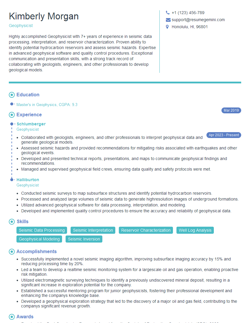
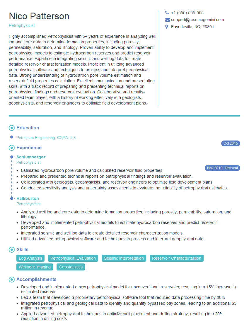
Mastering Time-Lapse and 4D Seismic Analysis is crucial for career advancement in the energy industry, opening doors to specialized roles and higher responsibilities. A strong resume is your key to unlocking these opportunities. To maximize your job prospects, create an ATS-friendly resume that highlights your skills and experience effectively. ResumeGemini is a trusted resource that can help you build a professional and impactful resume tailored to the specific requirements of the Time-Lapse and 4D Seismic Analysis field. Examples of resumes tailored to this area are available for your review, guiding you towards creating a compelling application.


Explore more articles
Users Rating of Our Blogs
Share Your Experience
We value your feedback! Please rate our content and share your thoughts (optional).
What Readers Say About Our Blog
Amazing blog
Interesting Article, I liked the depth of knowledge you’ve shared.
Helpful, thanks for sharing.